Location
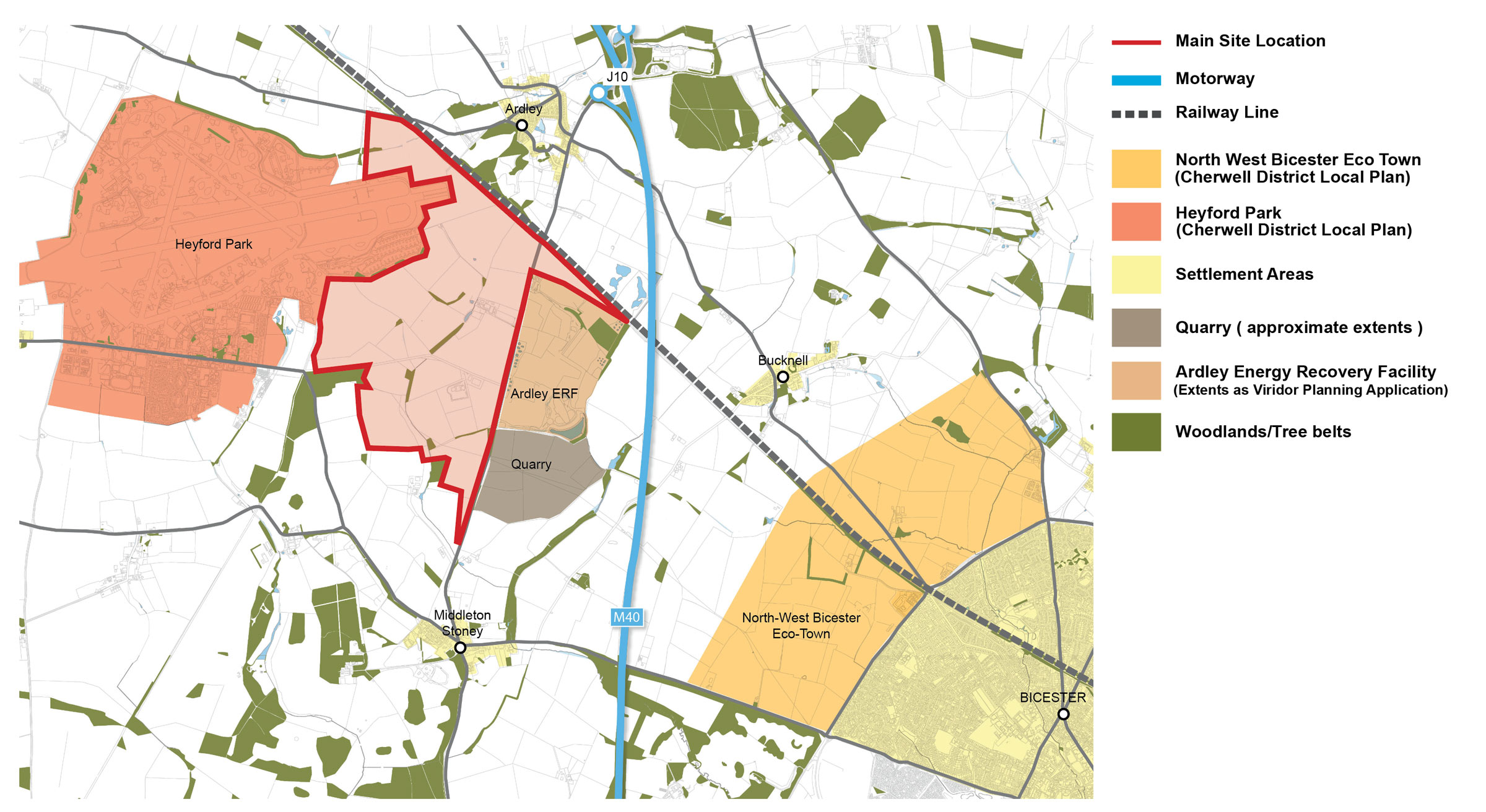
Oxfordshire Railfreight Limited is proposing a Strategic Rail Freight Interchange (SRFI) on land east of the former Upper Heyford Air Base, south of the Chiltern railway line, and southwest of Junction 10 of the M40 motorway.

A Strategic Rail Freight Interchange (SRFI) is a large multi-purpose freight interchange and distribution centre linked into both the rail and trunk road systems. It has rail-served warehousing and container handling facilities, and enables freight to be transferred between transport modes (i.e. from lorry to train or vice versa). An SRFI allows rail to be used to best effect to undertake the long-haul primary trunk journey, with other modes (usually road) providing the secondary, and often final, delivery leg of the journey.
Government policy set out in the National Policy Statement for National Networks (referred to as ‘the NPS’) is to encourage ‘a network’ of SRFI’s across the UK to help meet economic and environmental opportunities and challenges.


SRFI Location Requirements
The NPS recognises that the locations where SFRI’s will be appropriate across the country will be limited. This is largely because SRFI’s are required to have good access to both the Strategic Rail and Strategic Road networks, as well as having access to the markets they will serve. In part due to these and other functional requirements, including the minimum size of SRFIs (60 hectares/148.2 acres) and typical need for 24-hour operations, the Government recognises that SRFI’s may need to be located in the countryside as there are few sites within urban areas which meet these key criteria.
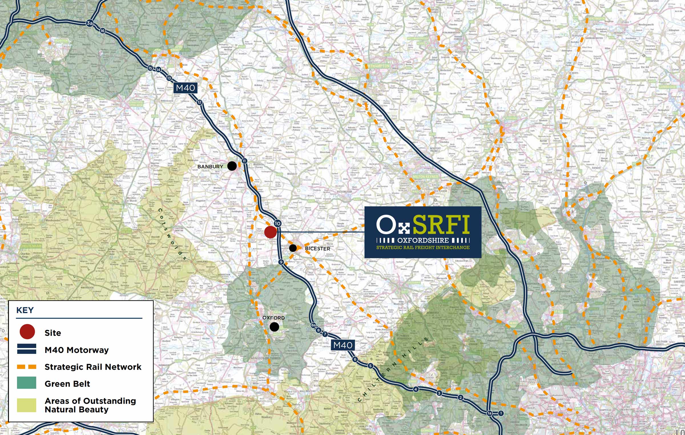
Given the linear nature of the key transport infrastructure networks, there are relatively few locations which are sufficiently close to both road and rail networks while also being in locations where such development would be appropriate in terms of land-use planning and environmental considerations. For example, the plan above shows the Strategic Road and Rail networks, as well as the Green Belts around Oxford, London, and the West Midlands conurbation to the northwest.
The proposed site is in an attractive and strategically significant location for distribution and logistics activity being located along the M40 between London and Birmingham and with the Chiltern Main Line – part of the Strategic Rail freight network – running adjacent to it. The site’s location means it is within a 4 hr drive of around 75% of the UK population.
The location is therefore well placed to expand the existing network of SRFIs, with good access to both Midlands and South-Eastern markets and distribution networks.
Attributes of the OXSRFI Location
ACCESS TO STRATEGIC ROAD AND RAIL NETWORK:
- Adjacent to M40 motorway which provides links between London and Birmingham.
- Proximity to the A34 and A43 trunk roads with access to the south-coast and Midlands.
- Direct link to the Chiltern Main Line, part of the Strategic Rail freight network.
ACCESS TO URBAN CENTRES AND MARKETS:
- Close to Oxford, Bicester and Banbury – areas subject to significant planned growth.
- Access to both London and Birmingham.
- Within 4 hours drive of approx. 75% of the UK population.
- The site is located in the Oxford-Cambridge Arc area of significant economic potential.
